


Peak leaf peeping season begins in Colorado: Here’s what to know, and how to locate your towed vehicle off Guanella Pass
Plus CDOT offers safety tips for drivers, and 5 other scenic drives to see the state’s fall color change
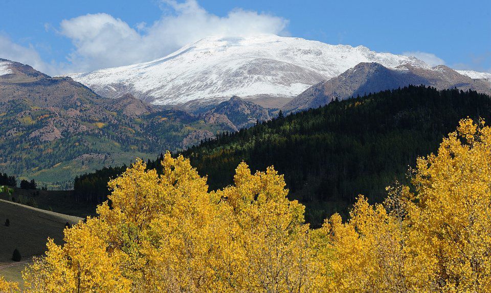
Colorado’s aspen trees are entering peak leaf changing currently and Colorado Department of Transportation is reminding drivers to anticipate additional traffic on roadways and to plan ahead, especially on weekends, as people head out to see the changing of the leaves.
CDOT said all drivers and pedestrians need to watch out for each other and maintain a safe environment for everyone.

This includes the very popular leaf-watching drive along Guanella Pass south of Georgetown in Clear Creek County, which accommodates between 10,000 to 20,000 vehicles a day during week days and between 25,000 to 30,000 vehicles daily on weekends.
CDOT said although the Guanella Pass Road between Georgetown/Interstate 70 and Grant/US 285 is not part of the state highway system, drivers should be aware that parking restrictions are in place at the top of the pass and extend at least a half mile to the north and south of the summit.
Clear Creek and Park counties implemented the restrictions to ensure emergency vehicles have the required access to maintain safety on the pass.
According to Clear Creek County Sheriff’s Office Communication Manger Jennifer Fulton officers have not towed any vehicles the past two weekends from near the Guanella Pass summit.
But she was quick to add: “as the peak leaf-peeping season starts, if vehicles need to be towed we are doing the following:”
- Towed vehicles will be taken to the Geneva Basin lot, which is at Mile Marker 11 on Guanella Pass Road in Clear Creek County. Park County will also be towing vehicles to this location.
- If a vehicle is towed, the CCCSO will put a traffic cone with the attached notification in the spot where the vehicle was illegally parked.
- If the CCCSO has to tow any vehicles, once it starts towing, it will have its Detentions van driving the roadway to shuttle any towed vehicle owners to Geneva Basin or a safe location where the owner can await personal transport.

“Our plan is to tow vehicles to Geneva Basin, but if the Geneva Basin lot fills up or we need additional towing companies to assist, it is possible the vehicles will be towed to the tow company’s lot,” Fulton said. “At a minimum, we will provide transportation to a location where the vehicle owner can make calls to locate their vehicle and/or arrange a ride.”
Denver Gazette news partner 9NEWS reported Friday that one group did experience a towing incident on Aug. 31 atop Guanella Pass after hiking in the area.
According to 9NEWS, Adam Dickerson and his parents returned to the spot where they had parked their vehicle to find it gone.
“The hike was great, we come down, and there’s no cars on the road at all,” Dickerson said. “And so, it was confusing, but quickly we realized that the car was towed.”

With no cell service on the pass, Dickerson said his family had limited options. At one point, his 71-year-old mother tried to flag down cars and ask rangers for help. The family eventually hitched a ride down to Georgetown, then back up to Silver Plume, where their car had been towed.
According to CDOT, leaf-viewing traffic at its peak on weekends, travelers should consider, if possible, traveling Tuesdays through Thursdays to ease traffic congestion and overcrowding for a more pleasant visitor experience.
However CDOT cautions if people are traveling on weekends, travelers still can encounter work zones on state highways. Weather-dependent projects sometimes take advantage of favorable conditions to continue construction before adverse weather stops work until spring.

Leaf Peeping Safety Tips:
- Be aware of vehicles traveling at lower speeds
- Watch for vehicles pulling off the roadway or parked along the road
- Find safe, designated areas to park
- Drivers, be aware of pedestrians out of their vehicles taking photos
- Pedestrians, watch out for passing vehicles
It is also a great time to kick off the autumn travel season with Colorado Byways #Roadtrip Weekend from Sept. 26 through Sept. 28. That weekend aligns with National Public Lands Day on Sept. 27. Pairing up a beautiful scenic drive along with the popular enjoyment and volunteer conservation of public lands can provide an economic boost to rural communities. The bonus: admission to the national parks and monuments is free on NPLD. For more information, visit: National Public Lands Day.
For those who would rather not drive on NPLD, CDOT’s Bustang to Estes bus service provides an alternative for travel to Estes Park and Rocky Mountain National Park. Tickets will be 25% off for the weekend of Sept. 27 and 28, and for the weekend of Sept. 20 and 21. For more information, visit: www.ridebustang.com and use the code ESTES25.

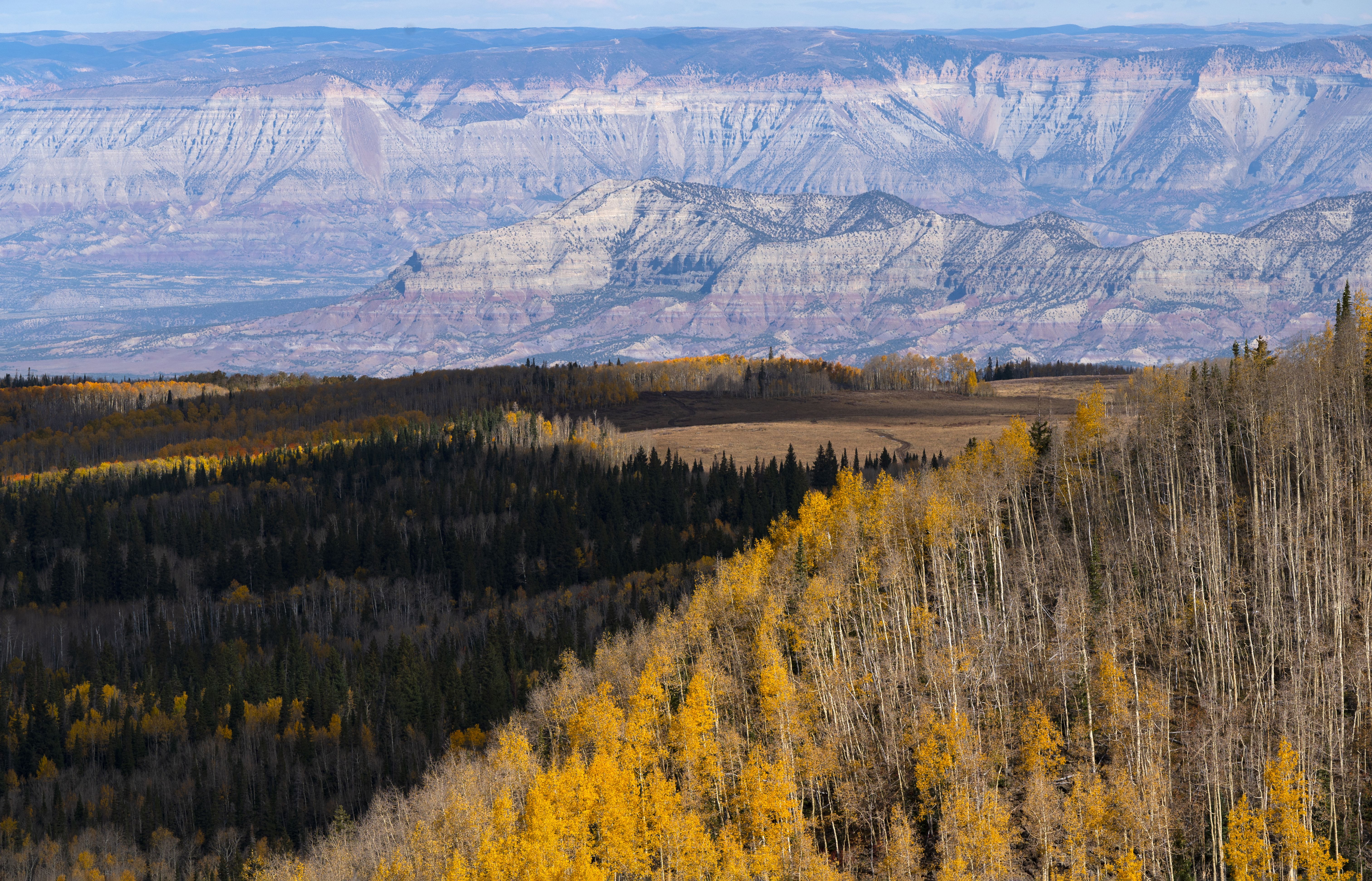
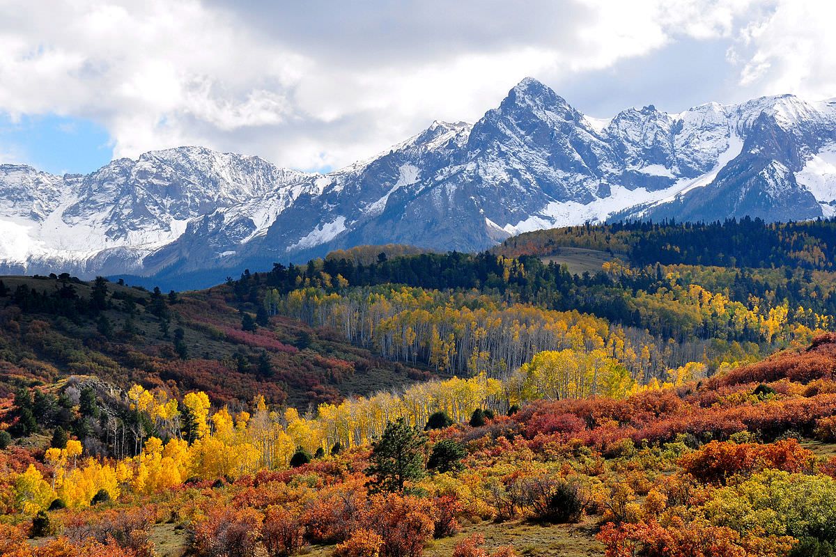
Five popular scenic driving routes to enjoy fall colors in Colorado:
Red Feather Lakes Loop – Fort Collins
This Northern Colorado route skirts 612,000 acres of the Roosevelt National Forest and features alpine lakes and a diversity of wildlife including Colorado’s state mammal, the bighorn sheep. The region’s scenic beauty is especially captivating during the fall when the foliage changes.
Northeast of Fort Collins, drivers can take northbound U.S. Highway 287 to the town of Livermore, where they will connect with Red Feather Lakes Road. Just south of the Lakes and near the loop’s halfway point is where Potbelly Restaurant and Lounge are. Connect to Manhattan Road (also known as Co Rd 69), and take it south to Rustic connecting with Colorado Highway 14, which travels back eastbound to Fort Collins.
Pikes Peak – Colorado Springs to the summit and back
Due to the variety of elevations and ecosystems along the drive to Pikes Peak’s summit, fall foliage enthusiasts will be able to witness a variety of colors (and even seasons!) on the way to the top. Be sure to bring a jacket for the summit.
From Colorado Springs, take U.S. Highway 24 west to Cascade and continue onto Pikes Peak Highway/Fountain Avenue, which eventually turns into a toll road to the Summit.
Glenwood Springs to Delta to Hotchkiss back to Glenwood Springs
This leaf viewing route takes approximately 10 hours total roundtrip from Denver and the leaf viewing loop will be approximately four hours of that drive. Plan accordingly to condense this into a day trip or extend it into an overnight stay.
Via the Front Range, take I-70 west 56 miles past Glenwood Springs to De Beque to connect with Colorado Highway 65 south, also known as the Grand Mesa Scenic Byway. Take CO 65 south to Delta to connect with Colorado Highway 92 eastbound. At Hotchkiss, connect to Colorado Highway 133 northbound to get to Carbondale, then connect to Colorado Highway 82 back to Glenwood Springs and the I-70.
Gunnison Loop – Front Range to Gunnison to Paonia and back
Leaf peepers should be prepared, as this is one of the longer routes that can be completed as a day trip. However, be advised that this route encompasses 10 to 11 hours of driving time. Those looking to embark on this adventure must be prepared for an early start, or stay overnight in Gunnison or Crested Butte. For campers, please note to camp only in designated camping areas on National Forest lands.
From the Front Range, take U.S. Highway 285 south to connect with U.S. Highway 50 westbound to Gunnison. Connect with Colorado Highway 92 west of Sapinero and take it northbound to Hotchkiss. Once in Hotchkiss, connect back to Colorado Highway 133 eastbound to go north to Carbondale. Connect onto Colorado Highway 82 and head south to summit Independence Pass east of Aspen. Connect to U.S. Highway 24 at Twin Lakes and either head north into Leadville and onto Interstate 70 to return to cities in northern Colorado or head south to connect to U.S Highway 285 then U.S Highway 24 to travel back to southern Colorado cities along the Front Range.
Southwest Colorado Loop: Durango/Cortez/Ridgeway
This route weighs in as the heavy hitter on this list, but trust us, it will be worth it. The drive itself clocks in at five hours of drive time in the southwestern corner of Colorado. For residents of the front range, we recommend tackling this with an overnight stay or as a multiday weekend excursion.
To reach the loop via Montrose from the Front Range, take U.S. Highway 50 from Pueblo or connect in Salida from Colorado Springs via U.S. Highways 24 and U.S. Highway 285. You can also connect to U.S. Highway 50 by taking U.S. 285 southbound from the Denver metro area.
To reach this loop via Durango, take I-25 south to connect to U.S. Highway 160 westbound at Walsenburg and take it all the way to Durango.
The loop can be taken westbound, taking U.S. Highway 160 west to Cortez before veering northwards towards Ridgeway via Colorado Highway 145. Once in Ridgeway, you can find your way back to Durango via U.S. Highway 550 through Ouray and Silverton. Alternatively, you can take the loop in reverse if starting in Ridgeway via Montrose.
PREV
PREVIOUS
Pedestrian killed in crash at U.S. 24 and I-25 identified
Colorado Springs police have identified Anthony Dutchak as the victim of a fatal crash at U.S. 24 and Interstate 25 on Sept. 10, according to a news release from the department Friday. Police responded to the MLK bypass at I-25 on Sept. 10 around 6 a.m. after a report of a crash between a vehicle […]

Q&A with Colorado lawmaker Barb Kirkmeyer | Republican says she'll be a governor who ‘knows how to govern’
State Sen. Barb Kirkmeyer says her decades of experience in government — as a county commissioner, director of a state department and state legislator — have prepared her to be a “really great governor,” and the Brighton Republican argues that’s what it’ll take to pull Colorado out of the tailspin she says it’s in. The […]